














As the threat of sophisticated GPS signal jamming escalates, the U.S. military is embarking on a pivotal initiative to develop resilient, unjammable navigation capabilities. The Defense Innovation Unit (DIU) has announced a new program aimed at accelerating the maturation of magnetic navigation (magnav) systems, promising an alternative that operates beyond the reach of adversary electronic warfare.
Navigating the Jamming Gauntlet
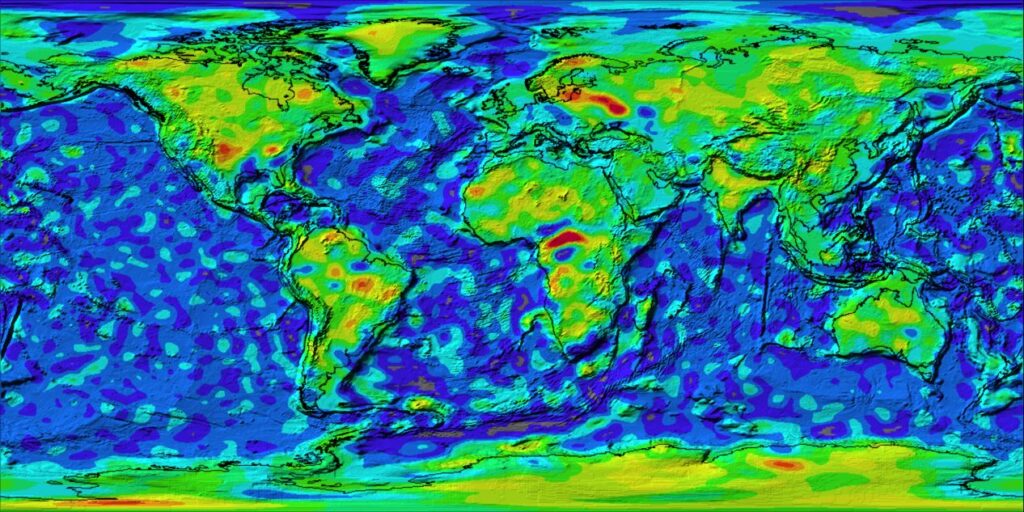
The omnipresence of global navigation satellite systems like GPS and China’s Beidou constellation has made them indispensable, yet their reliance on radio frequency (RF) signals leaves them vulnerable to detection and disruption. Magnav offers a compelling solution: it employs highly sensitive magnetometers to detect minute changes in the Earth’s terrestrial magnetic field, generated by magnetic rocks in the planet’s outer crust. Crucially, this is a passive technology. It broadcasts no RF signals, rendering it impervious to jamming and undetectable by adversaries – a distinct advantage in contested operational environments, especially over vast ocean expanses.
Charting the Earth’s Invisible Pathways
Despite its inherent resilience, the widespread military application of magnav has faced a significant hurdle: the lack of comprehensive, highly accurate, and localized „maps” of the Earth’s geomagnetic field. While geophysicists routinely utilize magnav for detailed geological surveys over land, the precision demanded for military navigation, particularly over oceans where visual landmarks are absent and magnetic anomalies can be subtle, remains a challenge. Existing commercial airborne platforms used for geological mapping typically lack the range necessary to conduct exhaustive surveys of vast marine territories.
Project GAUSS Takes Flight
To overcome this critical data gap, the DIU has launched its Geomagnetic Airborne Unmanned Survey System (GAUSS) program. This multi-year, multi-phase initiative seeks industry partners to prototype advanced magnetic data collection platforms specifically tailored to meet warfighter needs for precision navigation beyond GPS. The program emphasizes modifying existing airborne survey platforms for extended oceanic operations and developing cost-effective techniques to scale mapping efforts rapidly.
The DIU anticipates funding multiple types of aircraft and magnav systems. This could include high-altitude platforms operating around 30,000 feet for broad coverage, alongside aircraft scanning the ocean surface at approximately 2,000 feet for more detailed data. Furthermore, the program acknowledges the potential need for „attritable” or expendable aircraft in high-risk regions, underscoring the demand for both precision and affordability in these new systems.
Innovating for a Dynamic Field
Beyond static mapping, the GAUSS program is also actively pursuing „novel” techniques to address the Earth’s naturally fluctuating magnetic field, particularly the diurnal (day/night) variations observed over open oceans. Proposed solutions could involve integrating data from space weather monitoring systems or deploying „loitering diurnal monitoring assets,” such as high-altitude balloons, which are sometimes used by scientists to measure the Earth’s crustal magnetic field. This forward-thinking approach aims to ensure magnav systems can provide consistent and reliable data regardless of environmental shifts.
With the GAUSS program, the Pentagon is charting a course towards a future where navigation is not solely reliant on vulnerable satellite signals. By unlocking the full potential of magnetic navigation, the U.S. military aims to secure a critical, unjammable advantage in an increasingly contested operational landscape.